
Frequently Asked Questions
Straight answers about receivers, accuracy, RTK corrections, software, and working with Digital Mapping Group.
Receivers & accuracy
It depends on the accuracy your work needs. For asset mapping at submeter (30–60 cm) accuracy, the Arrow 100+ or Skadi 100 with free SBAS corrections is the usual fit. For centimeter work—as-builts, construction, utility locates—choose an RTK-capable model: Arrow 200+/300+ or Skadi 200/300, or the all-constellation Arrow Gold+ and Skadi Gold. Tell us what you map and the corrections available in your area and we will recommend a kit.
Not sure? Browse the receivers or talk to our team.
With free SBAS (WAAS) corrections, Eos submeter receivers deliver roughly 30–60 cm in real time. With RTK corrections from a base station or network, dual- and multi-frequency models deliver 1–2 cm horizontal accuracy. The Arrow Gold+ and Skadi Gold can also use Atlas® L-band or free Galileo HAS corrections for decimeter-level accuracy where no base or network exists. Real-world results depend on sky view, multipath, and your correction source—we help you size all three.
Both come from Eos Positioning Systems and share the same GNSS engines and accuracy tiers. Arrow receivers use an external antenna and are typically mounted on a range pole or vehicle. Skadi receivers integrate the antenna into a compact body that works handheld, on a pole, or on the Skadi Smart Handle—whose laser offset reaches up to 7 m (23 ft) for points you cannot safely stand on. Skadi also offers Tilt Compensation, so you do not need to plumb the pole.
No. Every receiver we sell works out of the box with free SBAS corrections and no recurring fees. For centimeter accuracy you add an RTK correction source: a free public network where one exists, your own FastRTK base station, or our FastRTK managed network at a flat annual cost with unlimited rovers. Atlas® L-band is an optional paid service for remote areas.
Yes. Arrow and Skadi receivers connect over Bluetooth to iOS, Android, and Windows devices and stream positions into any data-collection app that accepts external GNSS—ArcGIS Field Maps, Survey123, FastXY, and more. One receiver can even feed two devices at the same time.
Multi-constellation tracking (GPS, GLONASS, Galileo, BeiDou) keeps you working where single-constellation units drop out, but accuracy always degrades under heavy canopy or beside tall structures. Three things help: SafeRTK® holds RTK accuracy for up to 20 minutes when corrections drop out; the Skadi Smart Handle or a TruPulse laser lets you offset to a point you can see from a spot with open sky; and our team can recommend the right antenna and mounting for your environment.
Eos receivers are built for daily field use: rugged, waterproof, and lightweight, with all-day, field-replaceable batteries. Most crews carry a spare battery for long days and run the receiver from a vehicle or pole mount the rest of the time.
Can’t find an answer? Ask us.
Our team answers technical questions every day—receivers, corrections, software, workflows. Send us a note and a real person will get back to you.
Corrections, RTK & software
Real-Time Kinematic (RTK) uses a fixed base station to correct your rover’s position in real time, taking accuracy from submeter down to 1–2 cm. If your work needs centimeter accuracy—as-builts, construction stakeout, utility locating, elevations—you need RTK. If submeter is enough, free SBAS corrections will do. Read our guide: What is RTK?.
Three places: a public network run by a state DOT or university (free in many states), your own base station on site, or a managed network like FastRTK that streams corrections over the internet via NTRIP. Coverage, reliability, and support differ a lot between them—we will tell you honestly which fits your area.
FastRTK is Digital Mapping Group’s own RTK infrastructure line: permanent stationary base stations, portable mobile and mini base kits, NTRIP casting software, and fully managed correction networks. It lets you own your corrections at a flat annual cost with unlimited rovers, ±2 mm position stability, UHF, LTE, or Wi-Fi delivery, and a 15-minute critical-response SLA on managed networks. See FastRTK base stations.
Yes. A FastRTK stationary base on your building or yard gives your crews private corrections with no per-rover fees, and any Eos rover can also be set up as a temporary base for remote sites. We survey the base location, install and configure the hardware, and can host or monitor the NTRIP caster for you.
Satellite-Based Augmentation Systems—WAAS in North America—broadcast free corrections from geostationary satellites. Every Eos receiver uses them automatically, delivering 30–60 cm accuracy with nothing to configure and no subscription. It is the right choice for most GIS asset inventories.
On Eos RTK models, SafeRTK® keeps you at RTK accuracy for up to 20 minutes after corrections drop out—long enough to finish a feature in a dead zone. After that the receiver falls back gracefully to SBAS accuracy and reports the change in your app’s GNSS metadata, so you always know what you collected.
Any app that accepts an external Bluetooth GNSS receiver. The most common are Esri ArcGIS Field Maps, Survey123, and QuickCapture; our own FastXY app; and industry tools such as LocusView and CartoPac. Eos Tools Pro (free) sits alongside your app to monitor the receiver and manage RTK connections. Step-by-step setup guides for each app are in our Knowledge Base.
FastXY is Digital Mapping Group’s field app for capturing high-accuracy points and lines with Eos receivers—built for crews who want a simple, fast workflow without a full GIS deployment. Learn more about FastXY or watch the field demonstration.
Natively. ArcGIS Field Maps reads Eos receivers directly and stores accuracy, fix type, and correction age as attributes on every feature. Two free Eos add-ons extend it: Eos Laser Mapping for ArcGIS (laser offsets straight into Field Maps) and Eos Locate for ArcGIS (underground utility mapping). We run free workshops on these workflows.
Yes. Eos Locate™ for ArcGIS pairs a compatible utility locator with your Arrow or Skadi receiver so a technician can record the buried line’s position and depth below cover in a few seconds, directly into ArcGIS—no post-processing.
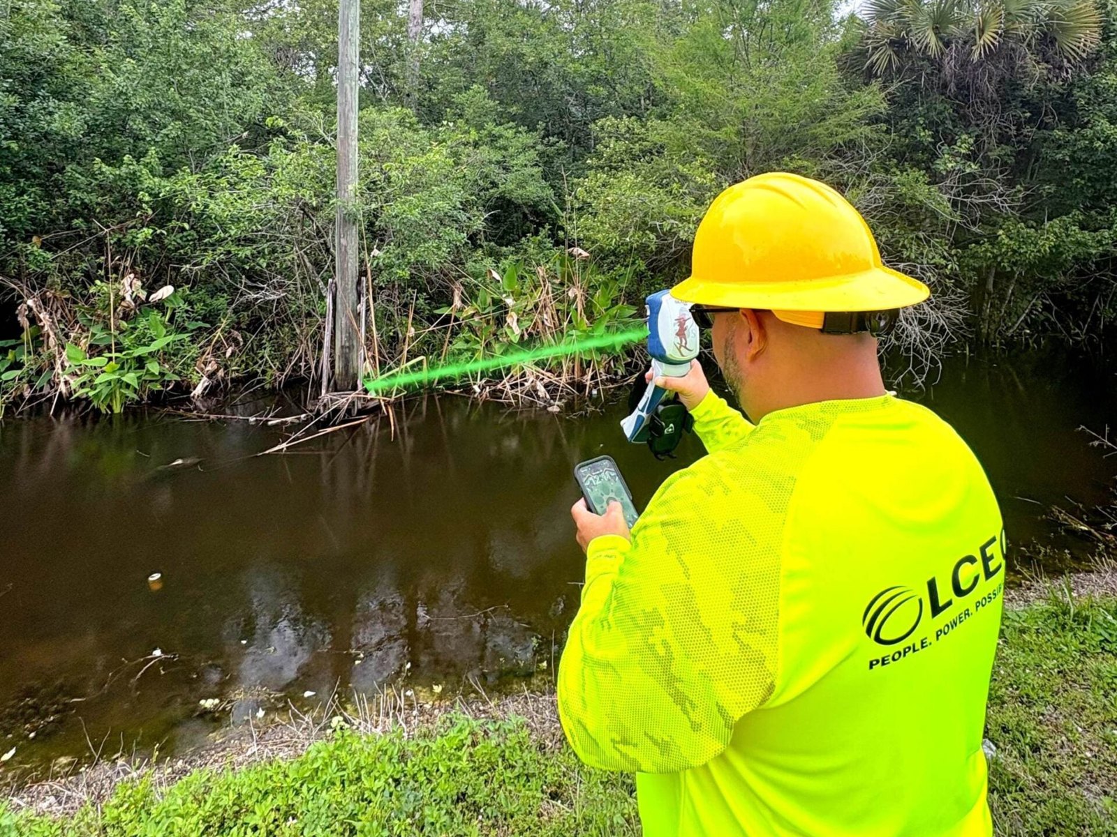
When you cannot stand on the point—a pole top, a trench, across a road or a river—you shoot it with a laser rangefinder and the software computes the position from your GNSS location plus the laser’s range and bearing. We sell and support Laser Technology TruPulse rangefinders for Eos Laser Mapping, and the Skadi Smart Handle has a built-in laser for offsets up to 7 m.
Yes, and most of it is free. We run instructional workshops and webinars on RTK fundamentals, datums and coordinate systems, and ArcGIS Field Maps workflows, plus one-on-one onboarding when your kit arrives. See upcoming and recorded workshops or browse our video library.
Ordering, support & warranty
Order directly from our online store, or contact us for a quote—especially for multi-unit purchases, RTK infrastructure, government or cooperative purchasing, or anything you would like configured to your workflow. We also distribute through resellers across North America.
Yes. We offer inspected and certified refurbished Eos receivers when available—a cost-effective way to add units to a crew. Stock changes, so ask us what is currently available.
Every kit ships configured and tested: receiver, batteries and charger, mounting hardware you ordered, and any RTK or NTRIP settings pre-loaded. Pair it with your device, open your app, and you are collecting data—most customers are in production the day the kit arrives.
Eos receivers and Laser Technology rangefinders are covered by the manufacturer’s warranty. If anything goes wrong, contact us first—we handle the diagnosis and the RMA with the manufacturer so you are not chasing anyone. Contact support.
If a product is not right for your work, contact us as soon as possible and we will walk you through the return or exchange. Returned items must be complete and in resalable condition; RTK infrastructure and custom-configured kits are handled case by case.
You get our US-based team in Portland, Oregon by phone and email, backed by Eos technical support five days a week. FastRTK managed-network customers also get uptime monitoring and a 15-minute critical-response SLA. And every customer can join our free workshops for as long as they own the equipment. Between calls, the Support Center lets you open and track a ticket, and the Knowledge Base has setup guides and how-tos.
Still have questions?
Send us a message
Tell us what you are mapping and what accuracy you need. We reply within one business day.