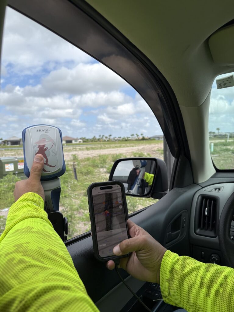
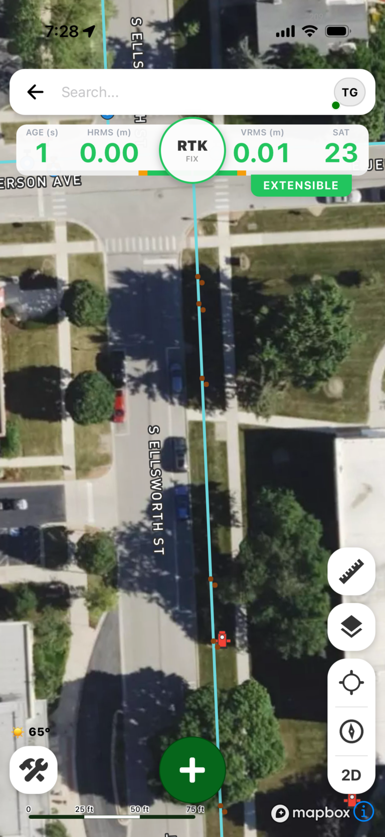
Digital Mapping Group has officially launched FastXY, a high-precision GNSS mapping application available for iOS and Android, as detailed in the March 6, 2026 press release. Designed specifically for geospatial information system (GIS) and architecture, engineering, and construction (AEC) professionals, FastXY converts standard mobile hardware into professional-grade field data collection instruments.
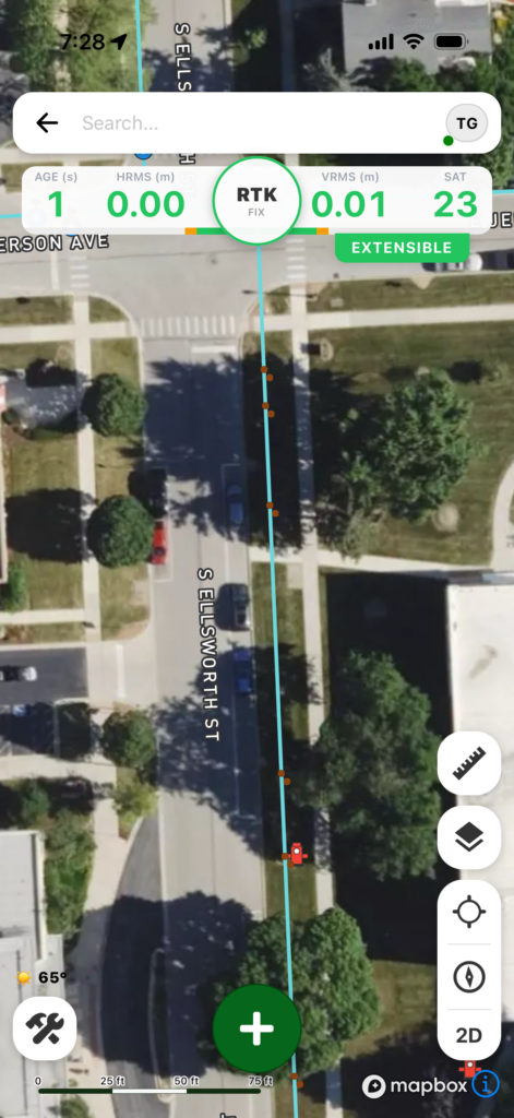
In response to the industry movement away from specialized, proprietary field hardware, FastXY enables field crews to collect point, line, and polygon spatial data using standard smartphones and tablets. Moving beyond basic mapping apps, FastXY incorporates advanced capabilities including 3D basemaps, topographic surveying, construction staking, real-time datum transformations, and survey-grade elevation collection.
Integrated Sensor Hub and External Hardware Interoperability
A core feature of FastXY is its integrated Bluetooth data parser (Sensor Hub). This capability enables users to interface with external instruments communicating over BLE Bluetooth or RS-232 serial connections—such as echosounders, laser rangefinders, radiation sensors, and barcode scanners—and immediately bind sensor telemetry with precise GNSS coordinates.
System Editions and Technical Capabilities
FastXY is deployed in two distinct operational tiers:
Essentials (Free Edition)
- High-Accuracy Compatibility: Supports internal device GNSS positioning as well as external Eos Positioning Systems Bluetooth GNSS receivers.
- Offline Architecture: Operates completely offline for field data collection and attribute editing without network connectivity.
- Spatial Visualization: Includes 3D basemaps featuring integrated satellite imagery, terrain models, and 3D building overlays.
- Smart Attribute Logic: Provides attribute picklists with integrated computational capabilities.
- Geodetic Engine: Performs real-time horizontal and vertical survey-grade datum transformations.
Professional Powerhouse (Premium Edition)
- Surveying & Navigation Tools: Includes advanced point staking, automated topographic data collection, and cross-track navigation interfaces.
- Hardware Integration: Delivers full support for Eos Positioning Systems’ Skadi Tilt compensation and Smart Handle hardware peripherals.
- Sensor Hub Configurator: Directly interfaces with peripheral instruments including laser rangefinders, echosounders, radiation sensors, and barcode readers.
- Data & Workflow Integration: Imports Trimble Data Dictionaries, CAD/GIS vector files, KML/KMZ datasets, and drone-acquired raster imagery.
- Post-Processing Workflows: Collects raw RINEX logging data and supports direct OPUS submission for static survey post-processing.
Software Availability
FastXY is available for immediate download on the Apple App Store and Google Play. Technical specifications and software documentation are available at fastxy.com.
Frequently Asked Questions (FAQ)
- What is FastXY?
FastXY is a high-precision GNSS mapping application for iOS and Android developed by Digital Mapping Group to transform standard mobile hardware into professional geospatial field instruments. - Who is FastXY designed for?
FastXY is engineered for geospatial information system (GIS) and architecture, engineering, and construction (AEC) industry professionals. - What main capabilities does FastXY offer?
FastXY supports point, line, and polygon data acquisition along with 3D basemap rendering, construction staking, topographic mapping, real-time datum transformations, and survey-grade elevation calculations. - What external hardware and sensors does FastXY support?
Through its Sensor Hub functionality, FastXY interfaces with BLE Bluetooth and RS-232 instruments—including echosounders, laser rangefinders, radiation sensors, and barcode scanners—as well as Eos Positioning Systems GNSS receivers, Skadi Tilt compensation, and Smart Handle hardware. - What versions of FastXY are available?
FastXY is available in two versions:- Essentials (Free Edition): Provides high-accuracy GNSS compatibility, offline operational support, 3D basemaps, smart attribute logic, and real-time datum transformations.
- Professional Powerhouse (Premium Edition): Delivers advanced staking and navigation, external sensor hub workflows, Eos hardware integration, advanced CAD/GIS/drone data imports, and RINEX logging with direct OPUS submission.
- Where is FastXY available for download?
FastXY can be downloaded from the Apple App Store and Google Play, with additional information provided at fastxy.com.
Ready to Upgrade Your Field Data Collection?
Experience high-precision GNSS mapping on your mobile device today. Download FastXY for free on the Apple App Store or Google Play, or visit fastxy.com to learn more about our features and hardware integrations.
This article is adapted from the press release ‘Digital Mapping Group launches high-precision GNSS mapping app FastXY’ by Tracy Cozzens, published on March 6, 2026.