The FastXY Application delivers efficient GIS/AEC Workflows for Professional Field Data Collection
In field data collection operations where precision and safety are critical, crews are often blocked by technologies that promise improved field mapping but fall short on flexibility. Traditional field mapping solutions are frequently cloud-only, offer limited metadata visibility, or impose hardware barriers that prevent smooth integration with third-party positioning systems.
Modern field data collection applications must act as a bridge—elevating GIS/AEC workflows by combining digital accuracy with seamless automation. With digital services and integrated project delivery accounting for 47.2% of the AEC technology market, the industry shift toward connected digital workflows is clear. Across commercial and infrastructure sectors, high-precision GNSS utilization is actively migrating from isolated, specialized hardware toward fully integrated digital ecosystems.
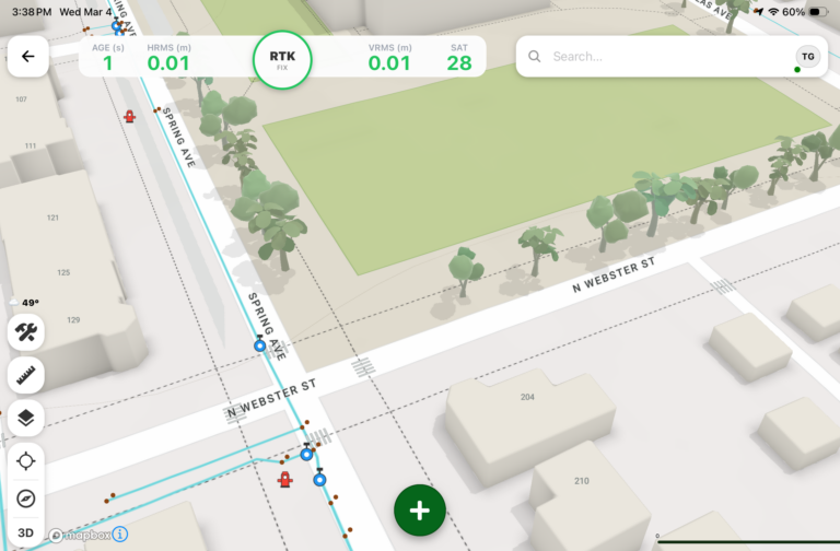
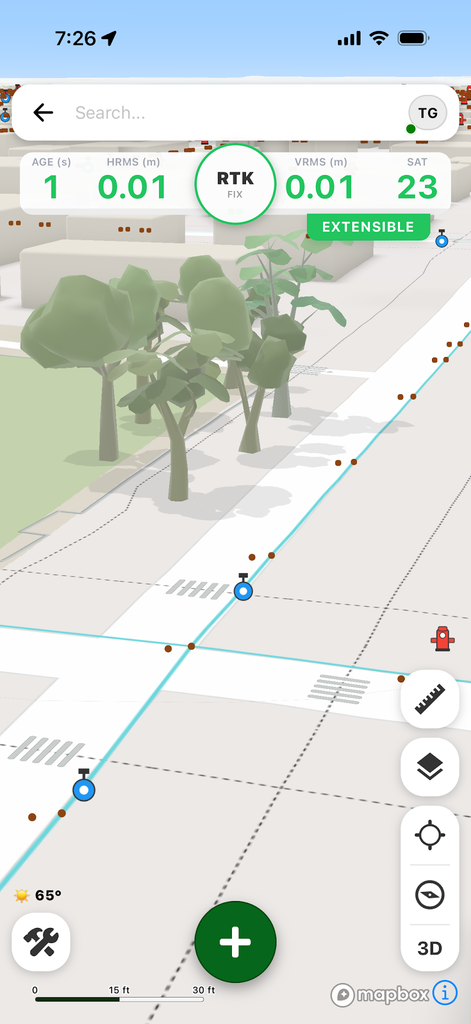
Leveraging the power of modern iOS and Android devices, the FastXY Application delivers efficient GIS/AEC Workflows for Professional Field Data Collection. FastXY delivers offline-first mobile mapping to instantly display and collect 3D basemaps, GIS data, and CAD data with responsive precision.
Working with GIS data? FastXY optimizes your GIS/AEC workflows by allowing you to create custom pick-list forms to capture points, lines, and polygons in a database structure that mirrors your system of record. Import your geodatabases, shapefiles, or KMZ/KML files, perform field edits or additions, and seamlessly push the updated data back to your GIS.
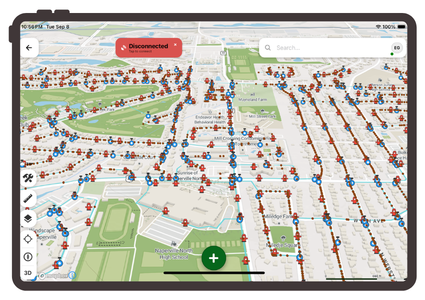
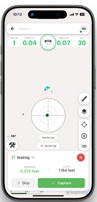
Working with CAD data? FastXY enables you to bring topographic surveys, grading plans, and staking layouts directly into the field. Work with your design files on-site with RTK centimeter-level accuracy for construction staking, utility locating, and grade checking.
Digital Mapping Group developed FastXY to serve specifically as a bridge between time-tested field practices and high-precision digital surveying. By transforming standard smartphones and tablets into professional field data collection tools, FastXY preserves familiar field methods while eliminating the manual friction of post-processing. Connecting traditional fieldcraft with modern spatial technology ensures a smooth path to complete digital transformation.
High-Precision GNSS and RTK Centimeter-Level Accuracy
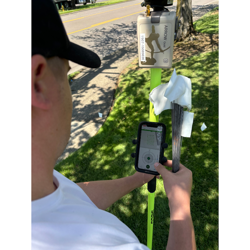
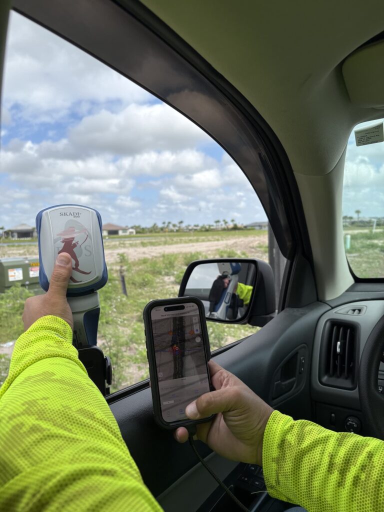
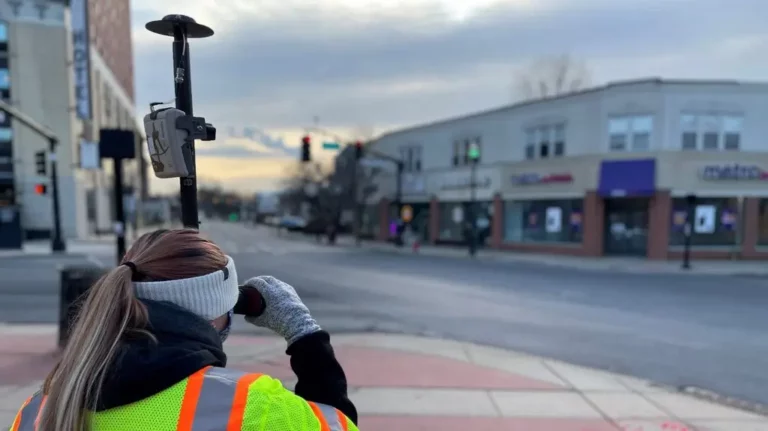
FastXY supports both internal device positioning and external high-precision GNSS Bluetooth receivers, streaming position data at rates up to 50Hz. The application provides native support for RTK centimeter-level accuracy and submeter positioning. With full compatibility for Eos Positioning Systems’ Skadi Series™ GNSS receivers, Skadi Tilt compensation, and Smart Handles, field data collection crews can maintain survey-grade accuracy even in challenging terrain.
To handle complex spatial calculations on the fly, FastXY features Smart Datum for real-time horizontal and vertical datum transformations based on the active correction source. Integrated GEOID model support delivers precise, survey-grade elevations directly during field data collection. An integrated NTRIP client enables direct streaming of RTK corrections, while user-configurable accuracy thresholds verify
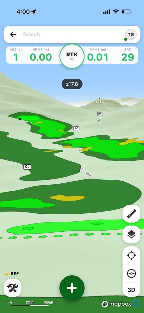
data quality before leaving the site.
The Sensor Hub: Multi-Instrument Integration
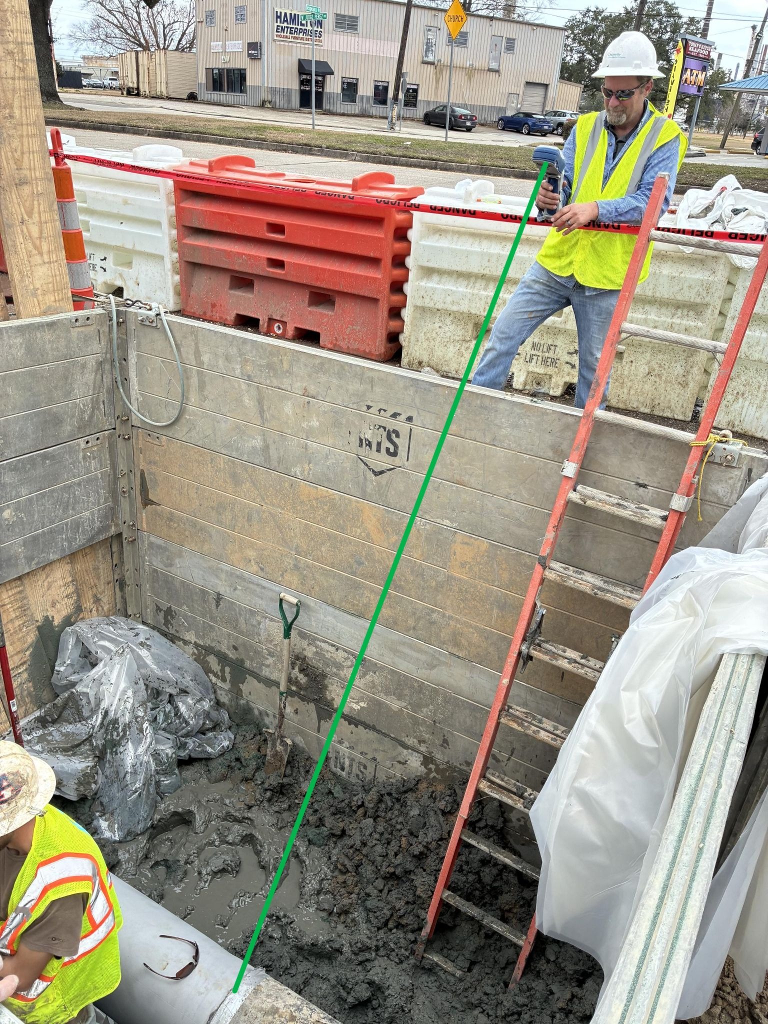
A stand-out technical capability of FastXY is its built-in Bluetooth data parser (Sensor Hub). With this feature, users can configure a custom interface to ingest raw serial streams via Bluetooth BLE or RS-232 from external sensors—such as echosounders, laser rangefinders, radiation detectors, and barcode scanners. FastXY automatically pairs these external sensor readings with high-precision GNSS time and position tags, eliminating manual data entry and multi-device correlation steps.
Offline-First Mobile Mapping and Advanced Visualization
Designed as an offline-first mobile mapping product, FastXY stores all project data locally on the host device, enabling full field data collection, editing, and feature creation without cellular or internet connectivity. For premium features, online authentication is required only once every 30 days. Field engineers can pre-download offline map tiles or leverage rich 3D basemaps—including terrain, USGS topographic layers, building overlays, GeoPDFs, and high-resolution UAS raster imagery.
Staking, Topography, and Data Interoperability
FastXY supports comprehensive field data collection and navigation workflows for vector data (points, lines, and polygons). Advanced tools for GIS/AEC workflows include construction point staking with cut/fill calculations, cross-track line guidance, and automated topographic data collection. To simplify project setup, FastXY allows direct import of Trimble Data Dictionaries and existing CAD or GIS schema.
For static surveying and high-accuracy post-processing, the app supports local RINEX logging with one-touch submission to NOAA’s Online Positioning User Service (OPUS). Collected data can be exported to standard engineering and mapping formats, including CSV for spreadsheets, DXF for CAD platforms, and KML/KMZ for spatial visualization.
Feature Comparison: Free vs. Premium Tiers
FastXY is available as a free download without requiring account registration. The Free tier includes essential field collection functions, internal or Bluetooth GNSS integration, offline data editing, smart attribute picklists, 3D basemaps, and real-time datum transformations.
The Premium tier unlocks advanced capability for GIS/AEC workflows and survey teams: auto-topographic mapping, construction staking with RTK centimeter-level accuracy cut/fill calculations, cross-track line navigation, external sensor hub pairing (echosounders, rangefinders, etc.), Eos Skadi tilt compensation, drone raster overlays, and RINEX/OPUS static post-processing workflows. A 30-day free trial of Premium features is included upon installation.
The Bridge to Practical Surveying
FastXY is more than just a mobile application; it is an enabler that connects tested field expertise with high-precision GNSS and a fully digital ecosystem. By allowing field crews to preserve their familiar, reliable methods while automatically unlocking modern GIS/AEC workflows, FastXY bridges the gap between legacy operations and next-generation offline-first mobile mapping.
Ultimately, FastXY delivers three critical advantages for modern organizations:
- Efficiency Without the Learning Curve: The core value proposition lies in enabling field crews to leverage their existing, field-tested expertise while incrementally upgrading to the advantages of digital workflows. Teams adopt modern tools seamlessly, avoiding the friction, cost, and operational downtime of disruptive retraining. This impact is measurable: industry data indicates that implementing GNSS-enabled GIS workflows can yield a $4.62 return on investment for every dollar spent, primarily by preventing costly mapping discrepancies and utility strikes.
- Reliability in Challenging Environments: Built on a robust offline-first mobile mapping architecture and backed by local data storage, high-precision GNSS integration, and advanced tilt compensation, FastXY guarantees complete dependability in remote, real-world conditions where cellular connectivity or internet access is unavailable.
- Unified Ecosystem: Serving as a centralized operational hub, FastXY consolidates raw data streams from external sensors—including high-precision GNSS receivers and laser rangefinders—into a single platform. It streamlines the end-to-end workflow from initial field capture to seamless CAD/GIS export, eliminating the need to juggle multiple standalone devices or fragmented software packages.
Exploring the Next Step in Field Efficiency
Check out the FastXY application to experience how modern offline-first mobile mapping can bridge the gap between traditional expertise and high-precision GNSS field data collection. By adopting FastXY, your team can realize the efficiency of digital transformation without the burden of a steep learning curve, ensure field-tested reliability in even the most challenging off-grid environments, and finally consolidate fragmented data streams into a single, unified ecosystem for GIS/AEC workflows. You can download and start collecting data immediately—no account required—by following our Get started guide. To unlock every professional workflow and experience the full power of the platform, we encourage you to sign up for a 30-day free trial of our Premium tier (no credit card required) at our Start free trial page.
Take a deeper dive into the data and insights behind this article from the following sources:
- Explore the Architectural, Engineering, And Construction Services Market Report 2033 by Grand View Research (June 2026) for market trends.
- Read Bess Utility Solutions’ article on Why Utility Locating is the New Construction Standard (2026) to see why locating standards are changing.
- Check out the full case study over at GPS World to read about the launch of the FastXY high-precision GNSS mapping app.